

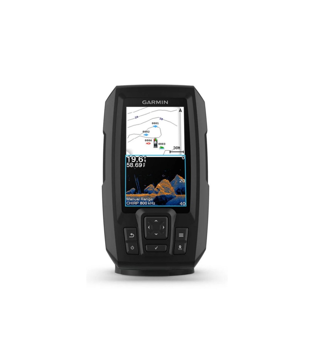

GPS Probe Plotter Garmin Striker Vivid 4cv with GT20 transducer

Observe the fish and structures with the highest level of detail after choosing the color of the screen, the location and the probe for your day in the water with the STRIKER VIVID 4CV probe with transducer.
The probe color you choose says a lot about your fishing style. Fortunately, you can choose between 7 new options of great intensity.
Deny views! Use the included transducer to obtain traditional chirp probes and Clearvü.
Always find the best fishing point. Use the Waypoints marking to find the way back.
And, by the way, the image of what is under the surface of the water with contours of 30 cm is quite impressive.

Great clarity and color probe
Choose between 7 new intense colors options to see both fish and structures with the highest level of contrast and clarity in your 4-inch probe.
Integrated probe
Use the GT20 transducer included to obtain the traditional Chirp probe and the Chirp Clearvü scan probe of Garmin.
Waypoints
To fish more fish, you need to know the best locations. Use the Waypoints marking to easily find the best fishing points.
High sensitivity GPS
Plan and create routes, and displays the speed of your boat in the probe through the high sensitivity GPS.
Quickdraw Contours
Nobody knows better than the waters in which you fish. With the STRIKER VIVID 4CV probe, you can store up to 8000 square kilometers of maps with contours of 30 centimeters
Included assembly components
The STRIKER VIVID 4CV probe includes a rotating / tilt support as well as components and a mounting mirror mirror and curriculum motor cable.
Physical and performance characteristics |
|
| Dimensions of the unit (width / high / depth) | 9.8 x 17.4 x 4.5 cm (3.9 '' x 6.9 '' x 1.8 '') |
|---|---|
| Weight | 0.3 kg (0.7 lb) |
| Water resistance classification | Ipx7 |
| Type of screen | Qsvga |
| Size of the screen (Width / High) | 2.1 "x 3.7" (5.4 x 9.5 cm); 4.3 "Diag, (10.9 cm) |
| Screen resolution (Width / High) | 272 x 480 pixels |
| Mounting options | FLUSH, TILT / SWIVEL |
| Screen keys | With keys |
Maps and Memory |
|
| Waypoints | 5000 |
|---|---|
| TRACK POINTS | 50,000 |
| Tracks | 50 |
| Routes | 100 |
Sensors |
|
| GPS | |
|---|---|
| Built-in receiver | |
| Compatible with WAAS | |
Optional map support |
|
| Garmin Quickdraw Contours | |
|---|---|
Electrical |
|
| Power supply | 12 to 20 VDC |
|---|---|
| Typical current consumption | 0.40 A |
| Maximum current consumption | 1.5 |
| Power consumption | 4.8 |
Specifications and probe functions |
|
| Show the probe | |
|---|---|
| Traditional probe (Dual Frequency) | Built-in |
| Clearvü | |
| Frequency | Traditional: 50/77/200 kHz chirp (high and a half frequency) Clearvü: 260/455/800 KHz |
| Transmission power | 300 W (RMS) |
| Locking in the background (shows the signals returned from the background to the surface) | |
| Graph and water temperature record | |
Connections |
|
| Ports for 4-pin transducer | 1 |
|---|---|
Fishfinder Functions |
|
| Zoom with split screen | |
|---|---|
| Fish symbol (helps identify fish) | |
| Automatic gain technology (allows detailed images of background structures and densities) | |
| Adjustable depth line (measures depth of objects underwater) | |
| A-Scope (Real-time shows fish that pass through the beam transducer) | |
| Temperature sensor included | |
| Custom depth scale | |
Legal and security information |
|
| Information on the EU data law - Nautical plotters, probes and transducers | |
|---|---|
Additional |
|
| Additional features |
|
|---|---|
 English
 Español
 Français
 Português PT
 Deutsch
 Italiano