


Navionics Platinum+XL Cartography Canary Islands - 000-11339-001
The same sea and lake content and the same advanced features of Navionics+ for GPS plotters enriched with 3D View, satellite overlay and panoramic photos of marinas and harbors. You'll be able to consult the widest set of resources, including port services and local points of interest, to help you venture into new waters with confidence.
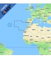
Navionics Platinum + XL Portugal to Azores cartography.
Navionics Platinum+ cartography contains detailed information with Mares navigation aids for your GPS Plotter Sonar with 3D views. All the information necessary for safe and accurate navigation. You will have applied information on port services, points of local interest, which will help you navigate with total confidence in unknown waters. Your fishing days, much more productive, thanks to its detailed bathymetry.
Compatibility: Works with the entire Lowrance (HDS Gen1, HDS Gen2, HDS Gen2 Touch, HDS Gen3, HDS Carbon, HDS Live, Elite HDI, Elite Chirp, Hook, Hook2, Elite-ti, Elite Ti2) and Simrad (NSS, NSSevo2, NSO, NSOevo2, GO, GO XSE, GO XSR and Cruise).