
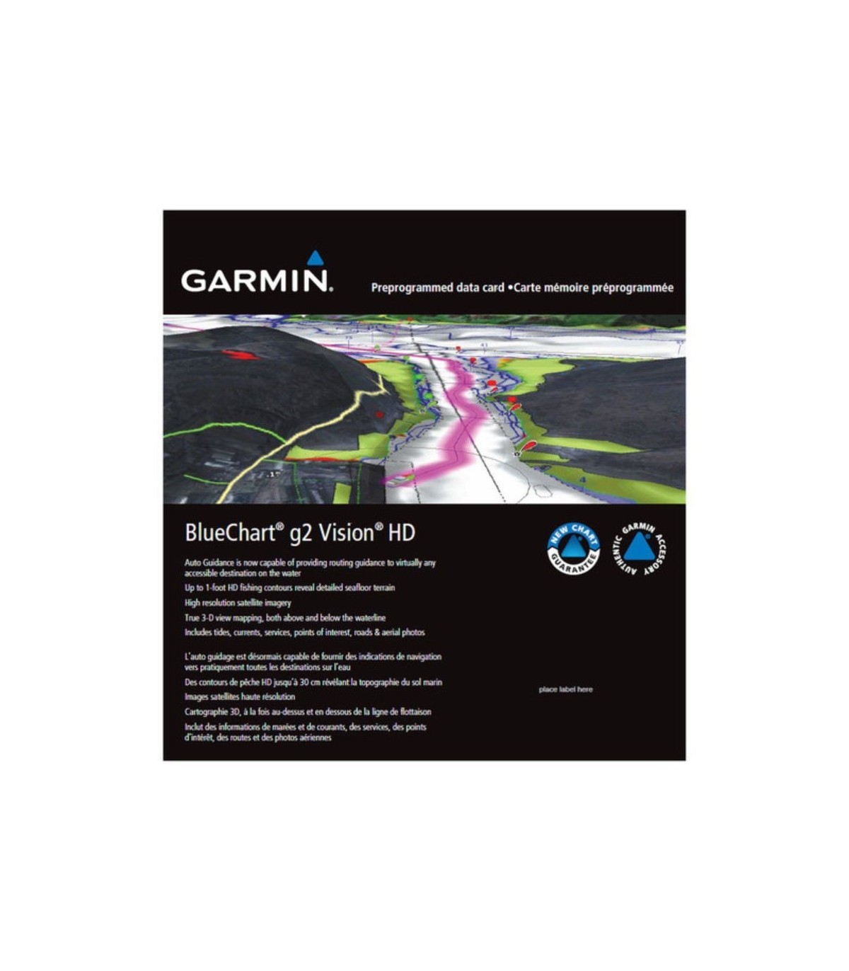

Garmin blch g2/g3 Vision cartography Madeira-Canary Islands

Enjoy unparalleled coverage and maximum detail while you navigate. BlueChart g3 charts offer industry-leading coverage, clarity, and detail with embedded Garmin and Navionics content.
- Industry-leading coverage, clarity, and detail with up-to-date charts that include integrated Garmin and Navionics ® content
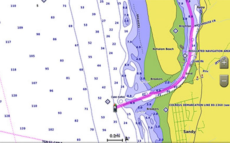
- Auto Guidance 1 technology quickly calculates a suggested route based on your desired depth and safety margin
- Includes custom depth scale for a total of up to 10 scales, allowing you to see target depth at a glance
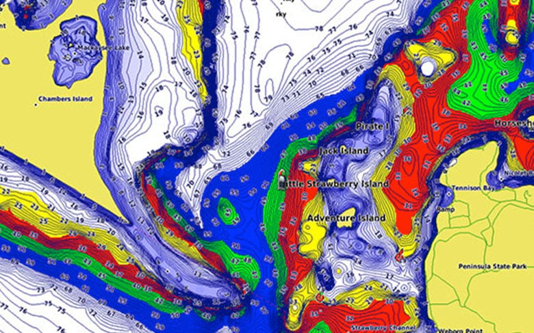
- Contours down to 1 foot provide a more accurate representation of bottom structure to give you improved fishing charts
- To show a clear picture of the shallows to avoid, the Shallows Custom Scale feature allows you to shade in a user-defined depth
auto route
For both boating and fishing, select a point and get a route showing the general course and nearby obstacles at a safe depth 1 .
Custom depth scale
This feature displays high resolution custom depth scales for up to 10 scales so you can see the depth of the target.
Shallow Water Custom Scale
To show a clear picture of shallow water to avoid, this feature allows you to shade in a user-defined depth.
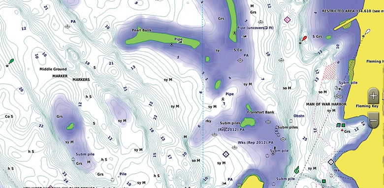
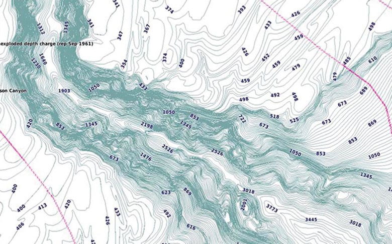
detailed outlines
BlueChart g3 Vision charts display 1-foot contours that provide a more accurate representation of bottom structure for enhanced fishing charts and greater detail on swamps, channels, and harbor plans.
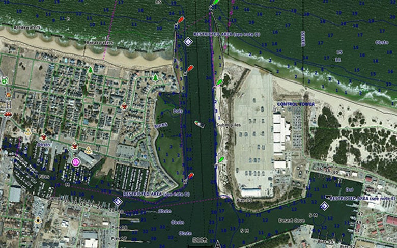
satellite images
Satellite images with chart overlays provide a realistic view of the environment. It's our most realistic mapping on a plotter, ideal for entering lesser known ports.
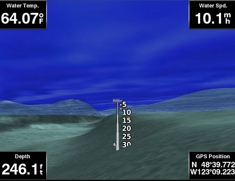
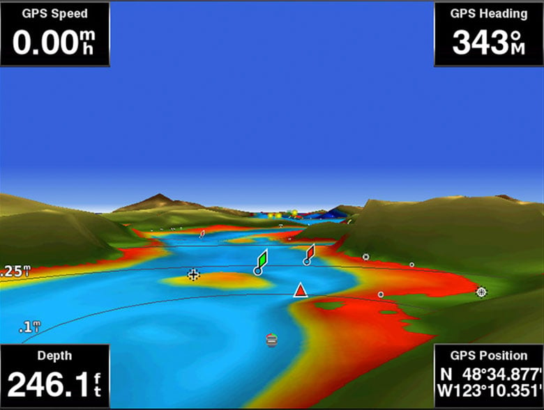
Fisheye view
This underwater perspective shows a 3-D representation of the bottom and contours as seen from below the waterline. Interface with sonar data for a personalized view.
MarinerEye view
This view provides a 3-D representation of the surrounding area, both above and below the waterline.
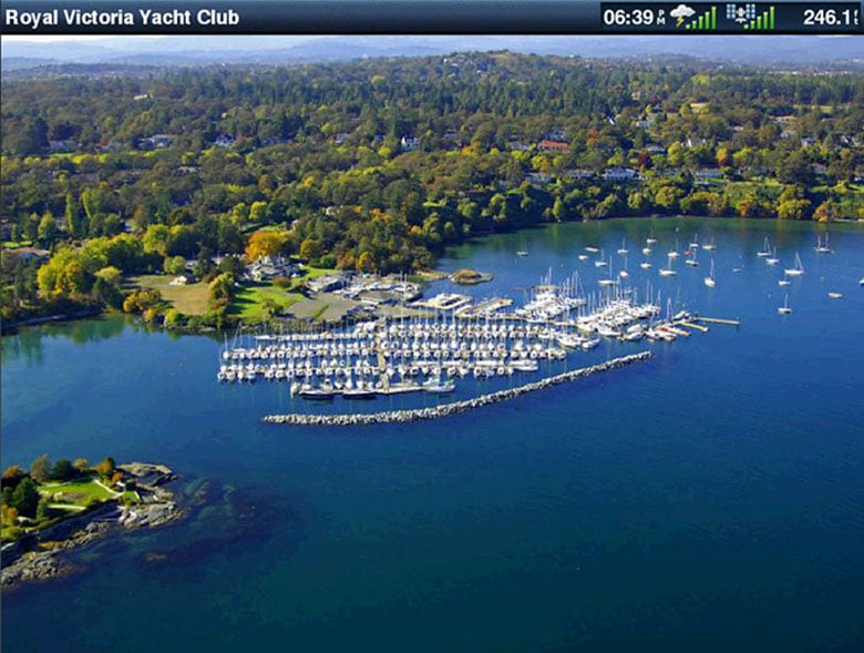
aerial photography
High-quality aerial photography provides exceptional detail of many harbors and marinas, ideal for accessing lesser-known ports.
1 The Auto Guidance feature has been created for planning purposes only and does not exempt you from responsible behavior in navigation operations